
The SMN indicates that hurricane “Juliette” in the Pacific Ocean is located southwest of the coasts of Baja California Sur, ceasing to affect the Mexican territory
Mexico.- For this day, the potential tropical cyclone No. 7 located off the coast of Tamaulipas and Veracruz, will generate a large area of clouds with a chance of heavy rains at torrential points in Nuevo León, Tamaulipas and Veracruz, which may generate landslides , increase in the flows of rivers and streams and floods in low zones of these states; in addition to heavy to very heavy rains accompanied by electrical activity in the northeast, east and southeast of the country, including the Yucatan Peninsula. On the other hand, a low pressure channel over the northwest and west of the Republic will cause heavy rain showers accompanied by electric shocks and possible hailstorms over the mentioned regions.
Hurricane “JULIETTE” in the Pacific Ocean is located southwest of the coast of Baja California Sur, ceasing to affect the Mexican territory.
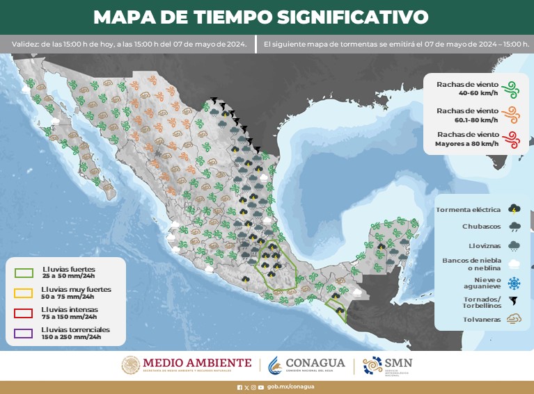
Precipitation forecast for today September 3, 2019:
Heavy rains at torrential points (150 to 250 liters per square meter): Tamaulipas and Veracruz.
Very heavy rains at intense punctures (75 to 150 liters per square meter): Nuevo León.
Heavy rain at very strong times (50 to 75 liters per square meter): San Luis Potosí, Hidalgo, Puebla, Oaxaca, Chiapas, Campeche and Yucatán.
Intervals of showers with heavy point rains (25 to 50 liters per square meter): Durango, Sinaloa, Nayarit, Jalisco, Colima, Michoacán, Guerrero, Tlaxcala, Querétaro, Tabasco and Quintana Roo.
Showers intervals (5.1 to 25 liters per square meter): Baja California, Baja California Sur, Sonora, Chihuahua, Coahuila, Zacatecas, Guanajuato, State of Mexico, Mexico City and Morelos.
Isolated showers (0.1 to 5.0 liters per square meter): Aguascalientes.
Under surveillance: Hurricane “JULIETTE” in the Pacific Ocean, southwest of Baja California Sur.
Potential Tropical Cyclone No. 7 in the Gulf of Mexico and Hurricane “DORIAN” Cat. 3 in the Atlantic Ocean, away from Mexican coasts.
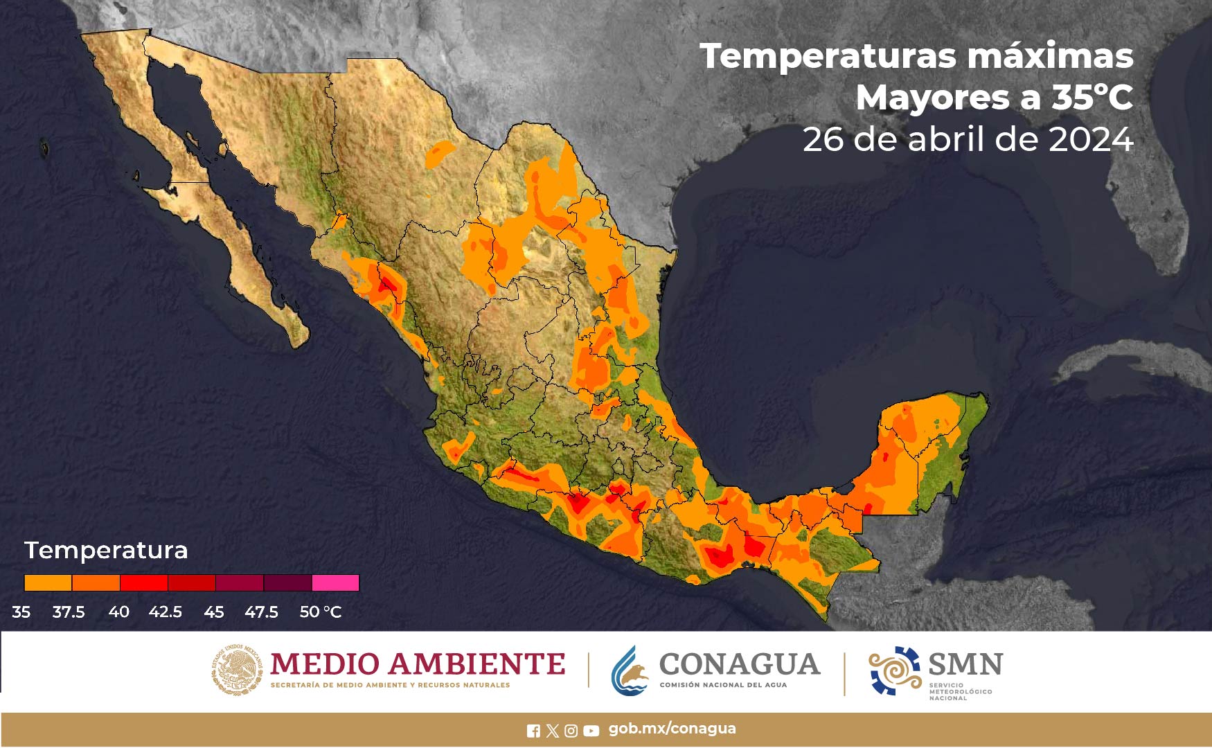
Forecast of maximum temperatures for today September 3, 2019:
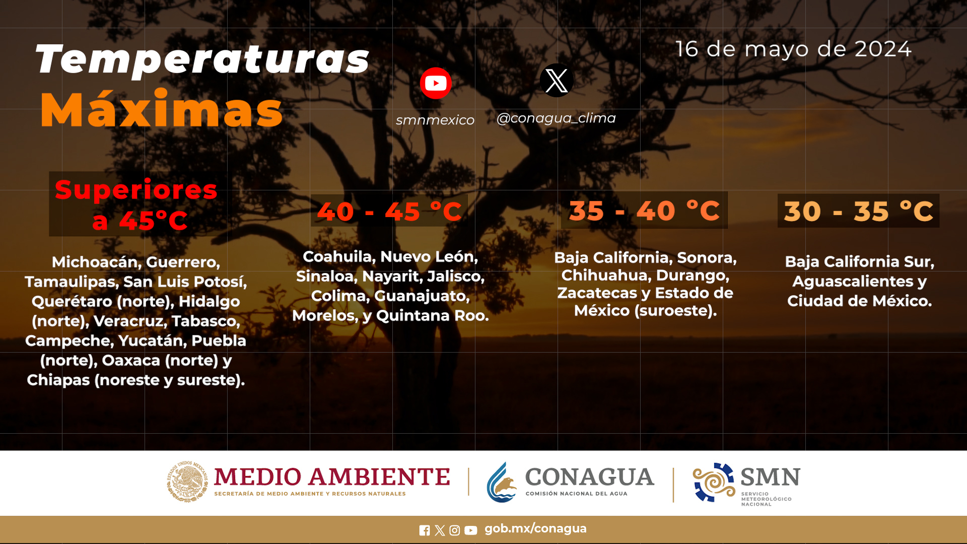
Temperatures above 45 ° C: Areas of Baja California and Sonora.
Temperatures from 40 to 45 ° C: Areas of Chihuahua, Coahuila, Nuevo León, Tamaulipas and San Luis Potosí.
Temperatures from 35 to 40 ° C: Areas of Baja California Sur, Sinaloa, Jalisco, Michoacán, Guerrero, Oaxaca, Hidalgo, Veracruz, Tabasco, Campeche, Yucatán and Quintana Roo.
Wind forecast for today September 3, 2019:
Wind with gusts greater than 60 km / h: Coasts of Tamaulipas and Veracruz.
Wind with gusts greater than 50 km / h: Zones of Coahuila, Nuevo León, Zacatecas and San Luis Potosí.
Forecast by regions:
Valle de México: Partly cloudy sky with an increase of cloudy in the afternoon and intervals of showers with electric shocks in the State of Mexico and in Mexico City. North wind between 10 and 25 km / h with gusts of 40 km / h. A maximum temperature of 25 to 27 ° C and a minimum temperature of 13 to 15 ° C is expected in Mexico City. For the State of Mexico, maximum temperature of 24 to 26 ° C and minimum of 5 to 7 ° C.
Baja California Peninsula: Partly cloudy sky with intervals of showers and electric shocks in the region. Morning fog banks on the western coast of Baja California. Very hot environment and northwest wind between 15 and 30 km / h.
North Pacific: Partly cloudy sky during the day with an increase of evening clouds and heavy rains in Sinaloa and intervals of showers in Sonora, which will be accompanied by electric shocks and possible hailstorms. Southwest wind between 10 and 25 km / h with gusts greater than 40 km / h.
Central Pacific: Cloudy sky in the afternoon with heavy rain in the region, accompanied by electric shocks and possible hailstorms. Hot weather during the day and west wind from 10 to 25 km / h with gusts of 45 km / h.
South Pacific: Cloudy sky in the afternoon with very strong punctual rains in Oaxaca and Chiapas, as well as strong in Guerrero; All accompanied by electric shocks and possible hailstorms. Very hot environment during the day. Variable direction wind from 10 to 25 km / h with gusts greater than 50 km / h in Oaxaca.
Gulf of Mexico: Cloudy sky during the day with occasional torrential rains in Tamaulipas and Veracruz, as well as heavy rains in Tabasco, these rains may generate possible landslides, increased river and stream flows and floods in low-lying areas of those states. Hot weather during the day and north and northeast winds from 10 to 25 km / h with gusts greater than 60 km / h in Tamaulipas and Veracruz.
Yucatan Peninsula: Partly cloudy sky with very heavy rains accompanied by electric shocks in Campeche and Yucatan, as well as strong in Quintana Roo. Hot and variable direction wind from 10 to 25 km / h with gusts greater than 40 km / h.
Mesa del Norte: Cloudy afternoon sky with heavy punctual rains in Nuevo León; very strong in San Luis Potosí, as well as heavy rains in Durango and intervals of showers in the rest of the region, the rains will be accompanied by electric shocks and possible hail fall. Very hot environment and east and northeast wind from 10 to 25 km / h with gusts of more than 50 km / h in storm areas.
Central Table: Partly cloudy sky during the day with increased cloudiness in the afternoon, and very heavy rains in Hidalgo and Puebla, strong in Tlaxcala and Querétaro, and intervals of showers in Guanajuato and Morelos, the rains will be accompanied by electric shocks. Warm atmosphere during the day and east wind from 10 to 25 km / h with gusts of up to 40 km / h in the region.
The maximum rains of the last 24 hours (in millimeters) were recorded in:
El Arcotete, Chis., 58.4; New Apollonia, Tamps., 31.5; Capetamaya (Navojoa), Son., 30.2; Guadalupe, Zac., 28.2; Necaxa, Pue., 22.8; Lagos de Moreno, Jal., 22.0; El Fuerte, Sin., 20.8; Morelos Múzquiz, Coah., 19.8 and Tecate, BC, 19.0.
The maximum temperatures (in ° C) were recorded in:
Matlapa, SLP, 40.2; Piedras Negras, Coah., 39.6; Altar, Son., 39.5; Cd. Constitución, BCS, 39.0; Tuxpan, Ver., 38.9; Cd. Juarez, Chih., 38.6; Cd. Victoria, Tamps., 37.8; Valladolid, Yuc., 37.5 and Tacubaya, CDMX, 25.5.
The minimum temperatures (in ° C) were recorded in:
Ocampo, Mich., 2.9; Huitzilac, Mor., 5.2; Temoaya, Edo. de Méx., 5.3; San José de Gracia, Ags., 7.1; Sanctorum de Lázaro Cárdenas, Tlax., 8.1; El Chico, Hgo., 8.6 and Airport, CDMX, 14.0.
Source: conagua
The Mazatlan Post


