
Mexicos temperatures will rise due to new atmospheric system
Low temperatures will continue during the mornings, but will rise during the rest of the day
Mazatlán, Sinaloa .- The coming days will see an increase in temperatures in the port of Mazatlán, reported the head of the Conagua Meteorological Service in Mazatlán, Hugo Nordahl Valdés.
“It is a high pressure system that is in the middle levels of the atmosphere, and this will cause stable weather, low probability of precipitation, they will be hot during the day and cool in the morning, mostly sunny this Tuesday, Wednesday and Thursday,” he explained.
He added that a cold front will also be causing winds of up to 50 to 60 km / h in the northwest of the country, however, the span of this system will be short.
He said that some areas of Sinaloa will record a maximum temperature of up to 40 degrees Celsius, while for Mazatlán it will remain stable.
“There will be little variation in morning temperatures, today the minimum was at 16.2 ° celcius; for the center and north of the state it will be 35 to 40 ° C and Mazatlán between 26 and 28 ° C,” he explained.
HEATWAVE OVER THE MEXICAN REPUBLIC, EXCEPT IN THE NORTHWEST
On this day, a high pressure system in the middle levels of the atmosphere will maintain the rise in temperatures and low probability of rain over most of Mexico with the exception of the northwest of the Republic. Whereas, a short cold front will cause strong winds with gusts of 50 to 60 km / h over the northwest and north of the national territory; the system will dissipate, ceasing to affect the country at the end of the day.
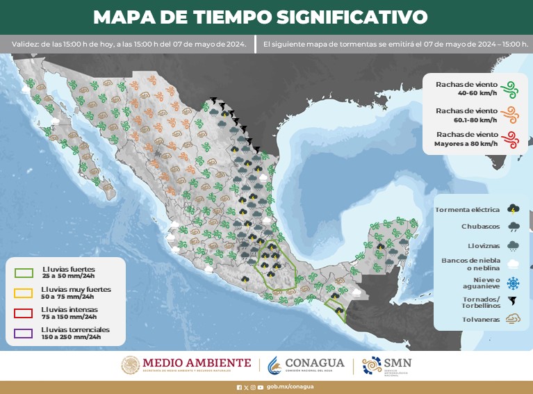
Precipitation forecast for today March 24, 2020:
Isolated showers (0.1 to 5.0 liters per square meter): Chiapas. Rains can be accompanied by electric shocks and hail fall
Forecast of minimum temperatures for today March 24, 2020:
Minimum temperatures from 0 to 5 ° C : Sierras de Baja California, Sonora and Chihuahua.
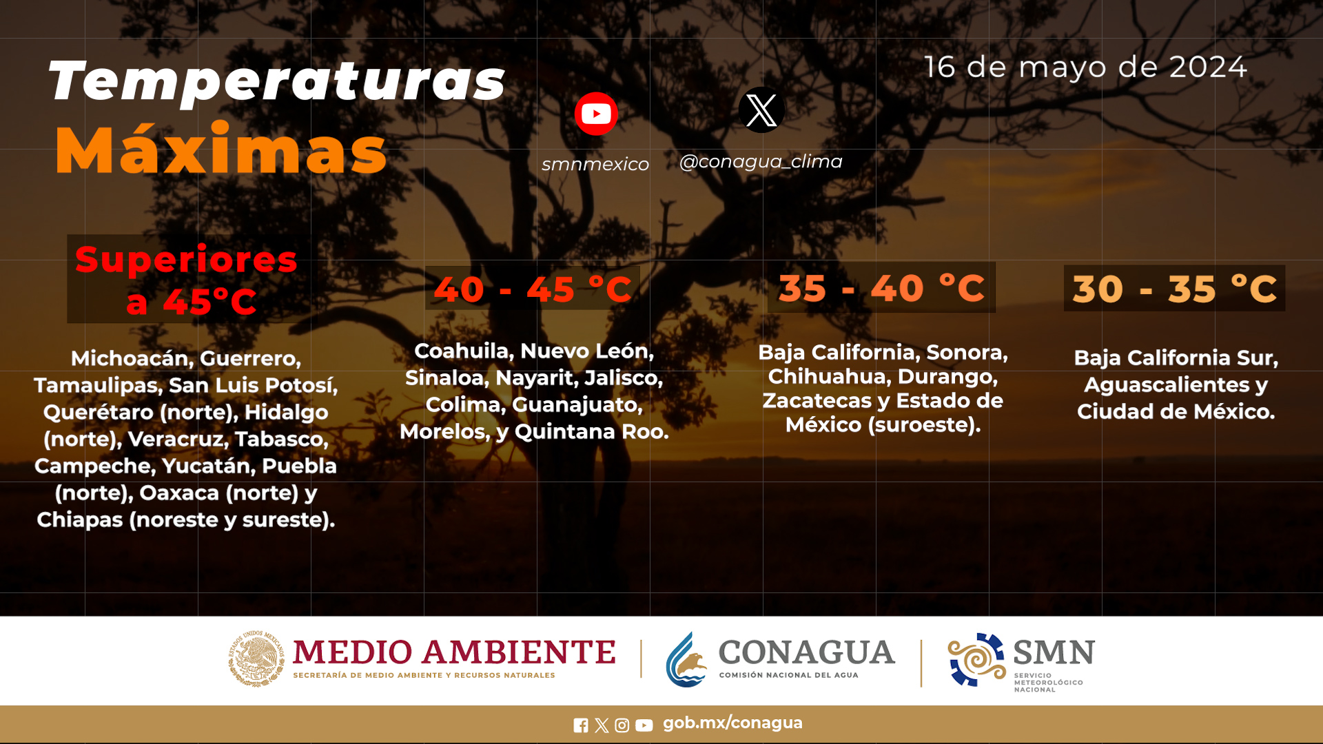
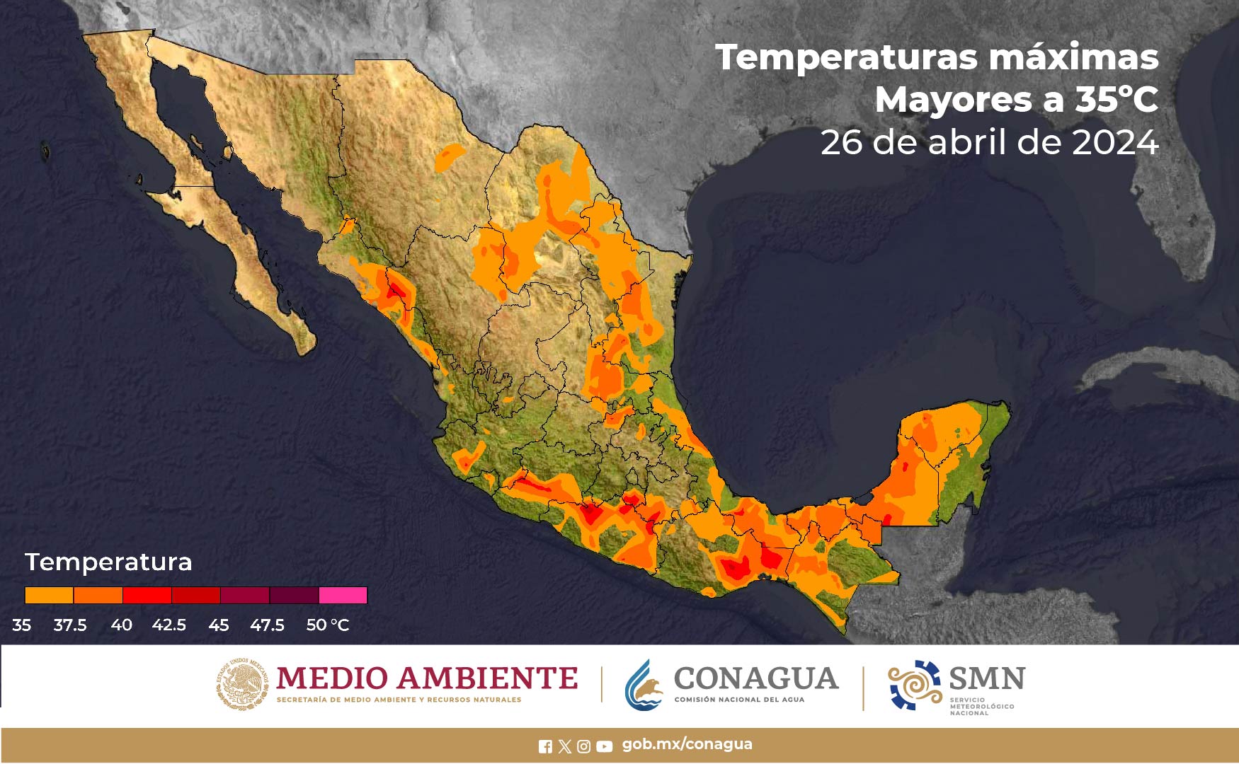
Forecast of maximum temperatures for today March 24, 2020:
Maximum temperatures of 40 ° C to 45 ° C : Nayarit, Jalisco, Michoacán, Guerrero, Chiapas, southwest of Puebla and south of Morelos.
Maximum temperatures from 35 ° C to 40 ° C : Chihuahua (east), Coahuila, Nuevo León, Tamaulipas, Durango (northeast), Sinaloa, San Luis Potosí (east), Colima, State of Mexico (southwest), Veracruz, Oaxaca, Tabasco, Campeche, Yucatán and Quintana Roo.
Wind forecast for today March 24, 2020:
Wind from the south with gusts of 60 to 70 km / h : Nuevo León and Tamaulipas.
Wind with gusts of 50 to 60 km / h : Baja California Sur, Chihuahua, Sinaloa and Durango. Forecast by regions:
Valley of Mexico: Clear sky during the day, without rain in the region. Light north and northeast wind 10 to 15 km / h with gusts of 25 km / h. In Mexico City a maximum temperature of 30 to 32 ° C and a minimum of 13 to 15 ° C is forecast. For the State of Mexico maximum temperature of 28 to 30 ° C and minimum of 11 to 13 ° C.
Baja California Peninsula : Clear sky with an increase of cloudy in the afternoon. Temperate environment in Baja California and warm in Baja California Sur. Northwest wind 10 to 25 km / h with gusts of 50 to 60 km / h in Baja California Sur.
North Pacific: Clear skies most of the day. Warm atmosphere in Sonora and hot in Sinaloa. West wind 10 to 25 km / h with gusts of 50 to 60 km / h in Sinaloa.
Central Pacific : Clear sky. Very hot environment and west wind from 10 to 25 km / h.
South Pacific: Partly cloudy sky with isolated rains in Chiapas. Very hot environment on the coasts of the region and west and southwest wind from 15 to 30 km / h.
Gulf of Mexico: Clear sky most of the day. Hot environment and south and southeast wind from 15 to 30 km / h with gusts of 60 to 70 km / h in Tamaulipas.
Yucatan Peninsula: Clear sky most of the day. Hot environment and east and northeast wind from 10 to 25 km / h with gusts of 40 km / h off the Yucatan coast.
North Table: Partly cloudy sky. Cool environment in the morning and hot in the afternoon. Variable direction wind from 15 to 30 km / h with gusts of 60 to 70 km / h in Nuevo León and from 50 to 60 km / h in the rest of the region.
Central Table: Clear sky most of the day. Warm atmosphere in the afternoon and east wind from 10 to 25 km / h.The maximum rains of the last 24 hours (in millimeters) were recorded in:Puente Palomas (V. Carranza), Pue., 5.6; Constitution of 1857 (Ensenada), BC, 4.4 and Technical Secondary 59 (Tuxtla Gutiérrez), Chis., 4.3.The maximum temperatures (in ° C) were recorded in:Salina Cruz, Oax., 38.6; Torreón, Coah., 38.5; Tuxtla Gutiérrez, Chis., 38.3; Choix, Sin., 38.0; Cd. Victoria, Tamps., 37.8; Campeche, Camp., 37.6; Zacatepec, Mor., 37.2 and Tacubaya, Cd. De Mex., 30.2.The minimum temperatures (in ° C) were recorded in:Basaseachi, Chih., -0.8; La Rumorosa, BC and Amanalco, Edo. de Mex., 0.3; Yécora, Son., 1.4; Las Vegas, Dgo. and Huitzilac, Mor., 2.4; y Aeropuerto, Mexico City, 12.0.

The National Water Commission, through the National Meteorological Service, will continue to report on the development of these phenomena through the Twitter account @conagua_clima, as well as the internet sites https://smn.conagua.gob.mx and www.conagua .gob.mxDate and time of the next forecast broadcast: March 24, 2020, at 6:00 p.m.
Source: conagua
The Mazatlan Post


